Ancient Theatre of Orhomenos ● Viotia
The ancient theatre of Orhomenos is built inside the walled acropolis of the 4th century BC. Archaeological finds suggest that it was built in a single building phase and completed in the 3rd century BC. It is one of the four preserved ancient theatres in the regional unit of Arkadia. The view from the theatre is spectacular, including a panoramic view of the fertile plain of Orhomenos and Kandila to the north and the theatre to the south.
Tanagra necropolis / Tanagra Kore ● Viotia
Dated from the Archaic until the early Roman times, the cemeteries of Tanagra offer important information about life and customs in those periods. Important archaeological finds include the statuettes known as “Tanagra kores”. These ancient Greek art pieces depict standing or sitting women and were manufactured from the 5th century BC onwards by the famous artists of Tanagra. They were used as funeral offerings or lucky charms.
Plataea ● Boeotia
Plataea is an important archaeological site, famous for the Battle of Plataea which was fought in 479 BC between the Greeks and the Persians. Homer and Herodotus mention the city as Plataea whereas Thucydides, Strabo and Pausanias as Plataeae. It was located at the borders of Attica, north from Kitheron mountain, between the mountain and Asopos river which formed a natural border with Thebes. The ruins of the ancient Greek city are located near the modern-day village.
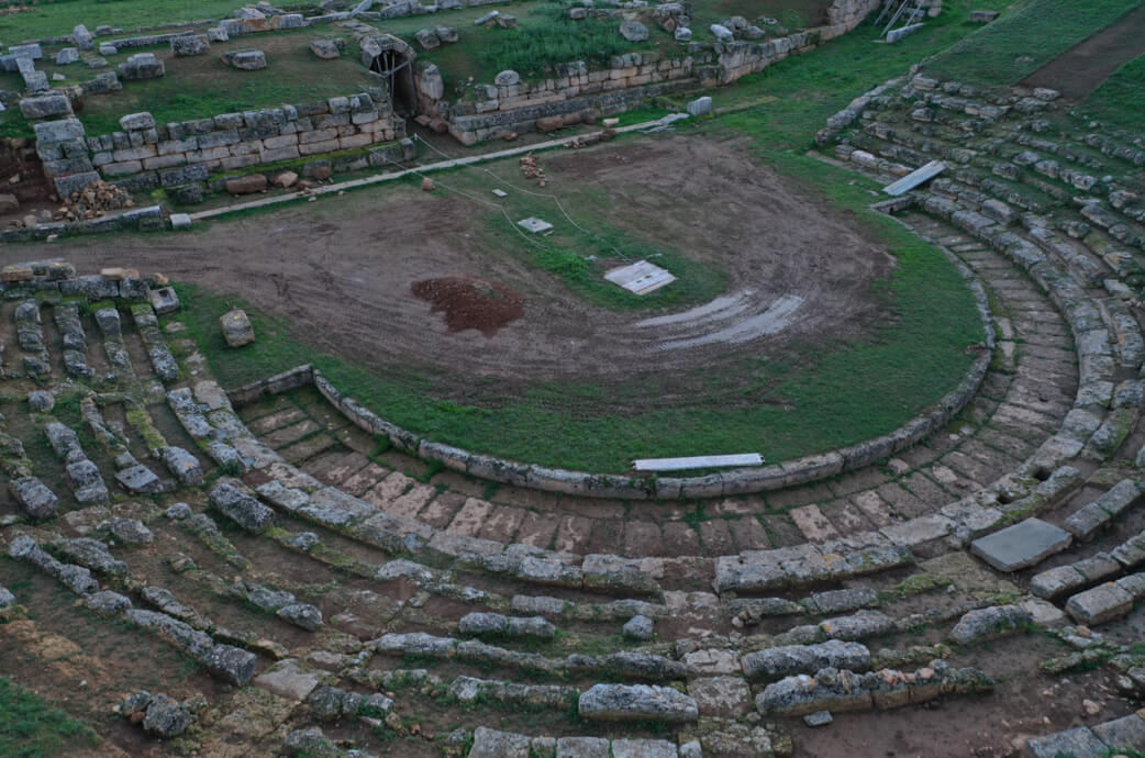
Ancient theatre of Kabeirion ● Viotia
Built at the slopes of a low natural hill, the theatre was dedicated to the gods Kabeiros and Paeda, as well as to Kabeiraea Demeter. The theatre hosted secret ceremonies aiming at strengthening fertility of any kind and a successful harvest. At its first building phase, it had twelve seating rows, only six of which are still preserved today. The façade of the west wing of the temple was used as a scene. The orchestra had a diameter of 26m and there was an altar.
National Park of Mount Parnassus
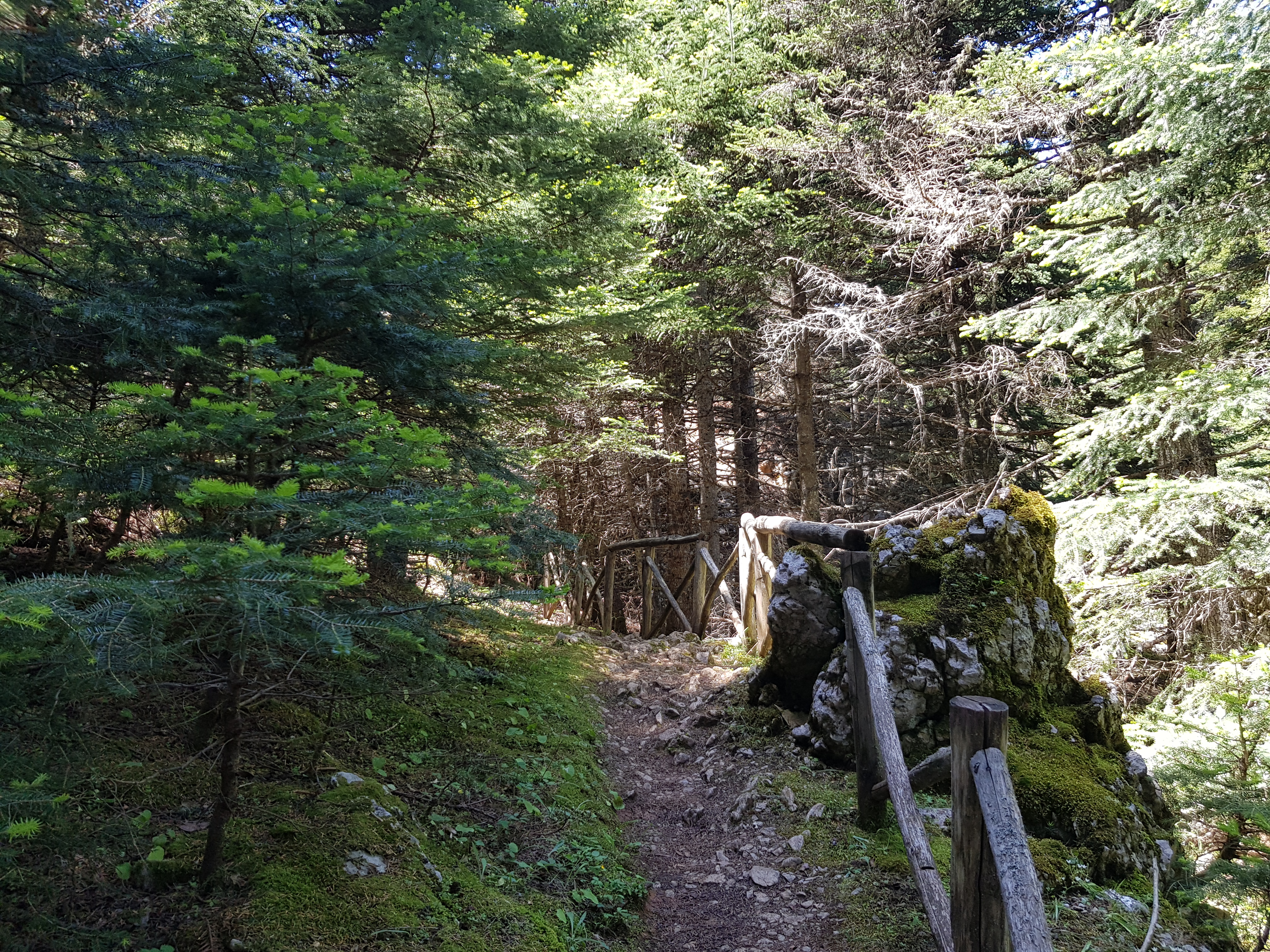
In the heart of Parnassus, at the borders of the regional units of Phocis and Boeotia, the National Park of Parnassus covers an area of 36km2 and was established in 1938. Besides the rich flora and fauna, visitors can also admire natural geomorphological formations of unique ecological and archaeological value, impressive waterfalls, crystal clear water springs, gorges covered in dense vegetation, and beautiful caves, while enjoying a variety of activities and the beauty of the Greek outdoors.
Waterfalls of Petra ● Viotia
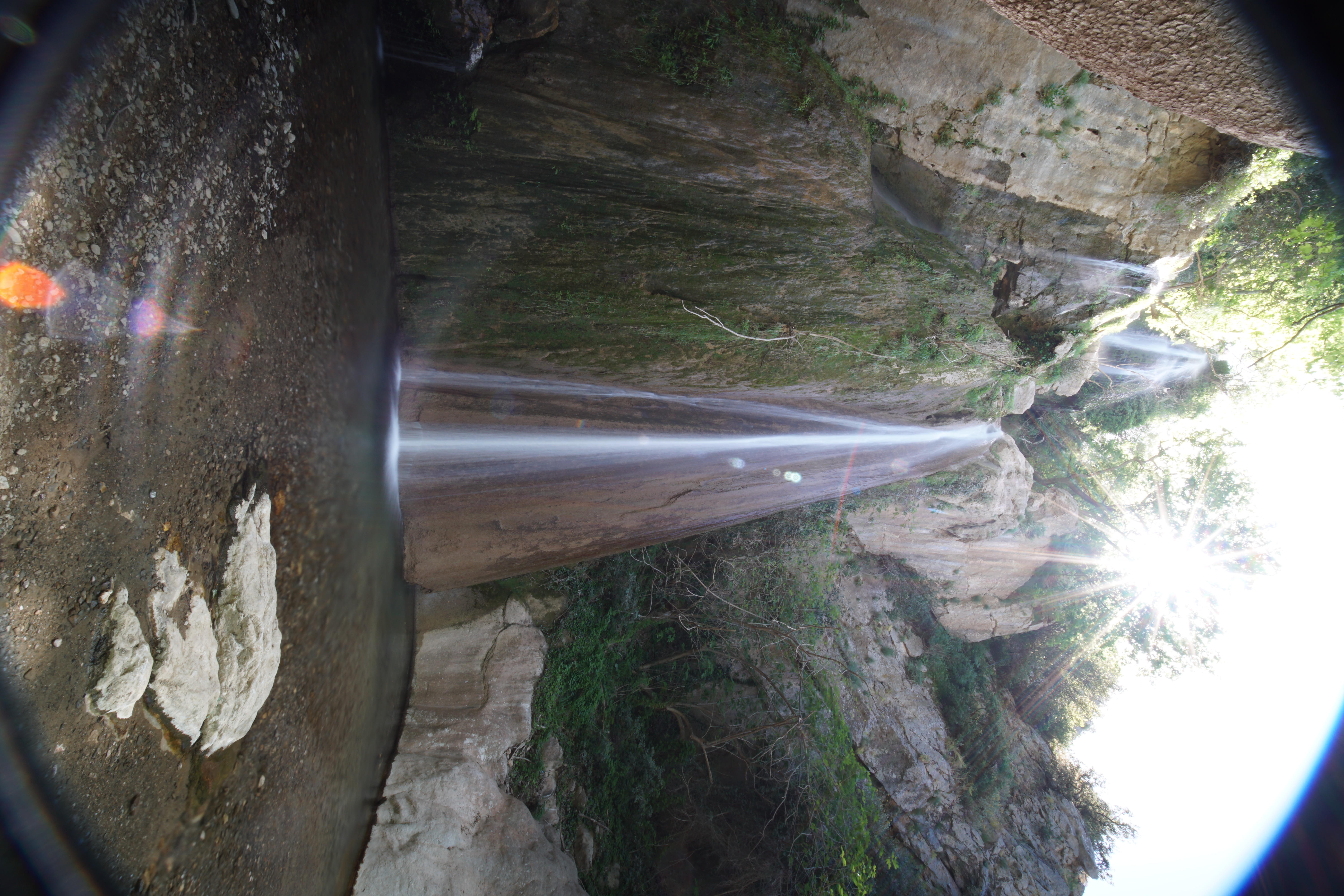
Within short distance from Petra village, the impressive waterfalls that were named after the village create a scenic landscape. They are located at the foothills of mount Elikonas, at an altitude of 200m, near Aliartos. The water falls from a height of 25m and as it continues its journey down the mountain slopes and the rocks, it descends again powerfully and creates two smaller, yet equally impressive waterfalls. Set in a landscape of unique beauty, these are the highest natural waterfalls in Greece.
Eptastomos Cave ● Viotia
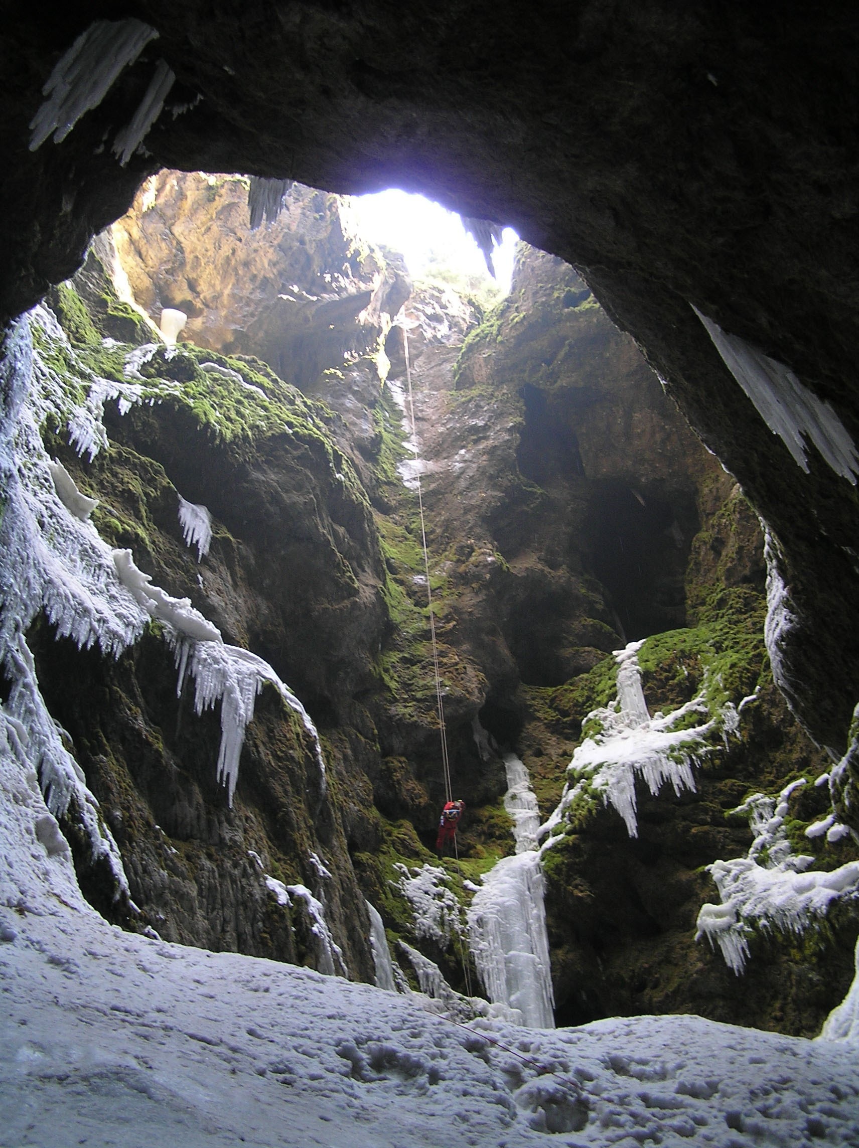
Full of stalagmites and stalactites, Eptastomos is one of the most beautiful caves in the country. Its weird name means “seven mouths” and was given because of the seven chasms leading to its interior. Located at an altitude of 1300m, it features an interior temperature between 0 and 2°C. Never-melting snow, spectacular waterfalls and a small lake with crystal clear waters are among the highlights, to be enjoyed by the few brave visitors who want to explore the cave.
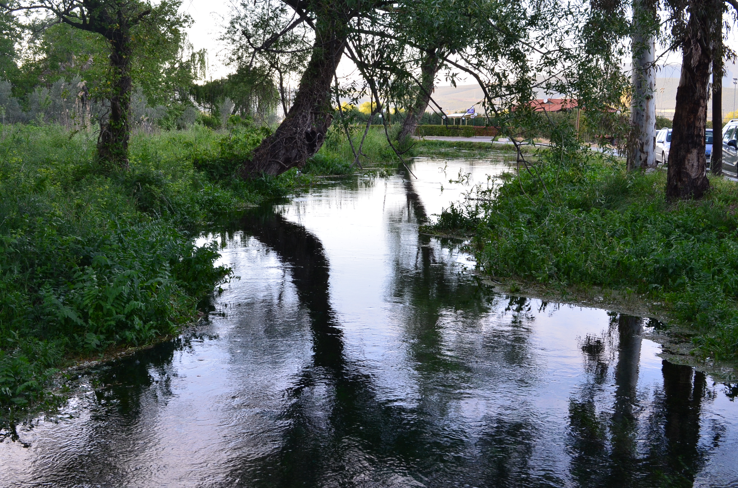
Boeotian Cephissus ● Viotia
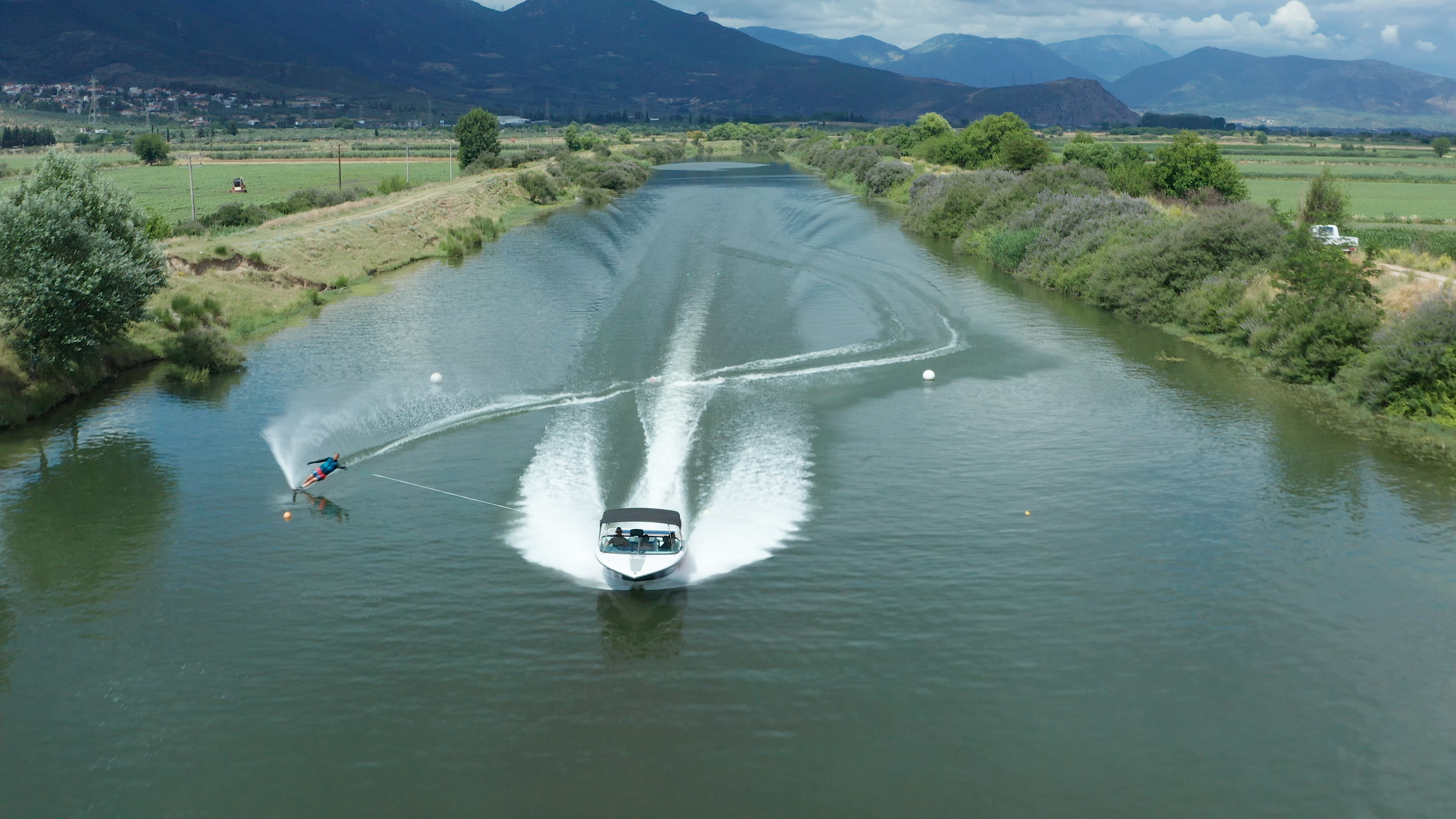
With a total length of 60km, this is the largest river in eastern Sterea Ellada and it crosses the regional units of Viotia and Fthiotida. It was two main sources, in Kastellia village on mount Gkiona and in villages Polydroso and Lilea in mount Parnassus. Crossing the fertile valley between the mountains Kallidromo and Parnassus and, through its branches, it irrigates the Kopaida plain, reaching its mouth in Lake Yliki. This is one of the top places in Greece and in Europe for water skiing, because of the optimal weather conditions and the few windy days.
Charites Water Springs ● Viotia
Located in a lush landscape, Charites water springs in Orhomenos, with their crystal-clear water, will, impress every visitor. They were named after a myth, according to which the three Charites (which means “Graces”), Zeus’ daughters, were born and worshipped here. In Akidalia spring, the Charites would bathe Aphrodite, perfume her and dress her with her “ambrosian veil” which was woven by themselves.
Krya Water Springs ● Viotia
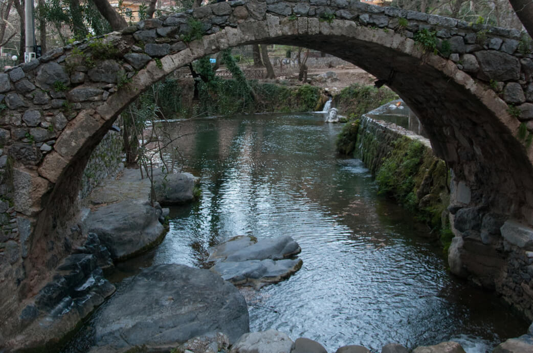
Flowing through Livadeia, river Erkinas creates a beautiful natural landscape and forms the formidable water springs, at a short distance from the city. Running waters, stone bridges, plane trees and water mills create a unique scenery attracting visitors, who can also visit the stone-built theatre of Krya located within short distance.
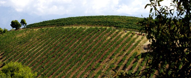
Elikonas ● Viotia
Ancient and more recent travellers describe Elikonas as a mythical place where the Muses would dance, charmed by the beauty of the ancient mountain. This valley in Boeotia was said to be the place where the Muses actually lived. A place of incomparable beauty, combining scenic landscapes with tastes. Covered with firs and oaks, the slopes view over the Corinthian Gulf and Kopaida plain. The vineyards that are preserved until today give to the visitor the opportunity to taste the “nectar” of the Muses.
Kopaida plain ● Viotia
In the prehistoric times, this plain used to be the largest lake in Greece. It had been formed by the waters of Boeotian Cephissus, river Melanas and other streams flowing from the surrounding mountains. While Kopaida was a lake, some areas along its shores were cultivated and crops were frequently destroyed due of flooding. For the first time, the lake was drained in antiquity and then in 1876, resulting in the formation of a cultivable area of 250km2. At about its centre stands an “islet” called Gla, which is surrounded by an ancient fortification wall.
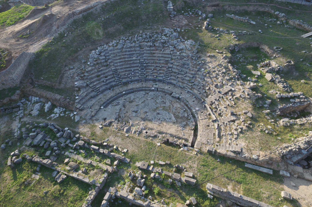
Ancient theatre of Eretria ● Evia
One of the oldest known ancient theatres, the theatre of Eretria had a capacity of 6300 spectators and is located in the west section of the city, among the west gate, the stadium and the upper gymnasium. The archaeological finds show that it was originally built in the 5th century BC, after the Persian wars and the rebuilding of the city, and it flourished in the 4th century BC. After Eretria was destroyed by the Romans in 198 BC, it was rebuilt with material of less value.
Dragonhouses in Karystos ● Evia
Famous structures that are located in the south part of the island, near Styra, Karystos and the peak of mount Ochi. These 23 rectangular constructions date from the 5th century BC and still stand imposingly, even though they have no foundations and no binding material. The breath-taking views leave visitors in awe. According to the legends, these were the residences of mythical “dragons” after which the houses were named.
Towers & castles ● Evia
These special monuments stand imposingly among settlements, hills and fertile valleys along the island and impress visitors. They are remnants of the Latin presence in the Eastern Mediterranean area and symbols of the feudal society developed in Euboea from the 13th until the 15th century. In the past, they were centres of the economic activity of the wider area and provided a strong defence system against potential enemies. Today, they continue to awaken the interest of travellers in the regional unit.
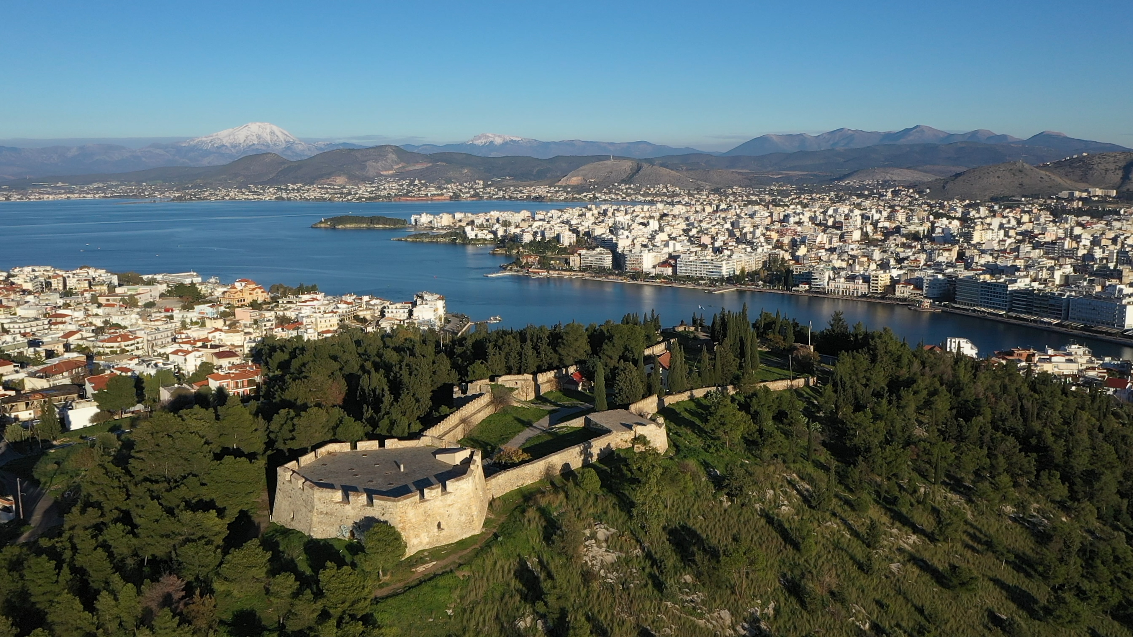
Chalkida Bridge ● Evia
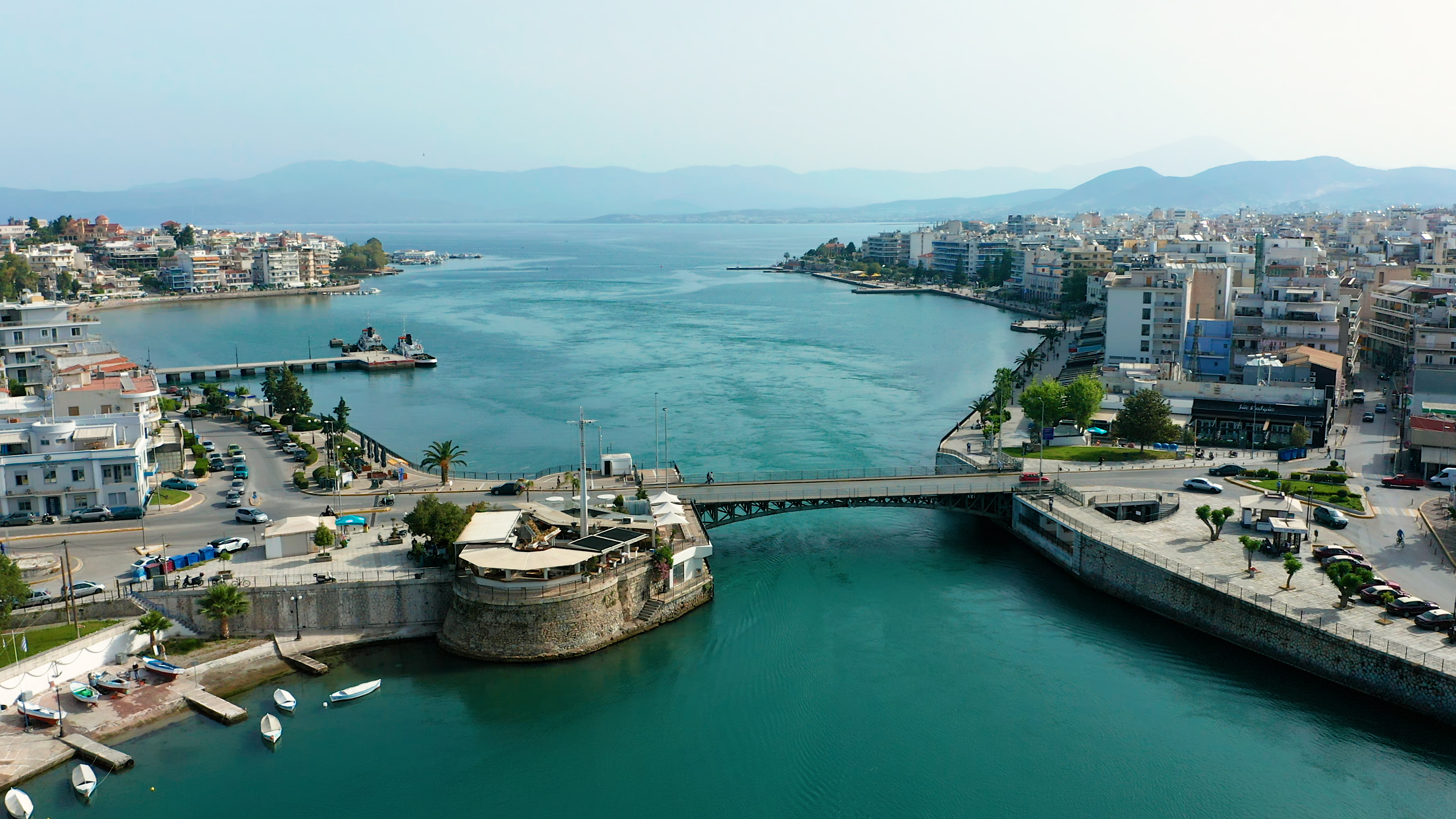
The bridge across the Euripus Strait counts 2500 years of history. As early as in 410 BC, a wooden bridge was constructed to connect the shores of Viotia and Evia. Later on, in 510 AD, it was replaced by a cable-braced bridge and during the Ottoman period by a wooden stable bridge. In 1858 it was transformed into a wooden drawbridge and in 1896, it was replaced by a cast-iron swing bridge, which was finally replaced by the current bridge in 1962. It is an important landmark in Chalkida and a “balcony” with a view of Euripus, from where one can observe the tidal phenomenon, during which the currents change direction every 6 hours.
Tidal phenomenon of Evripos, Chalkida ● Evia
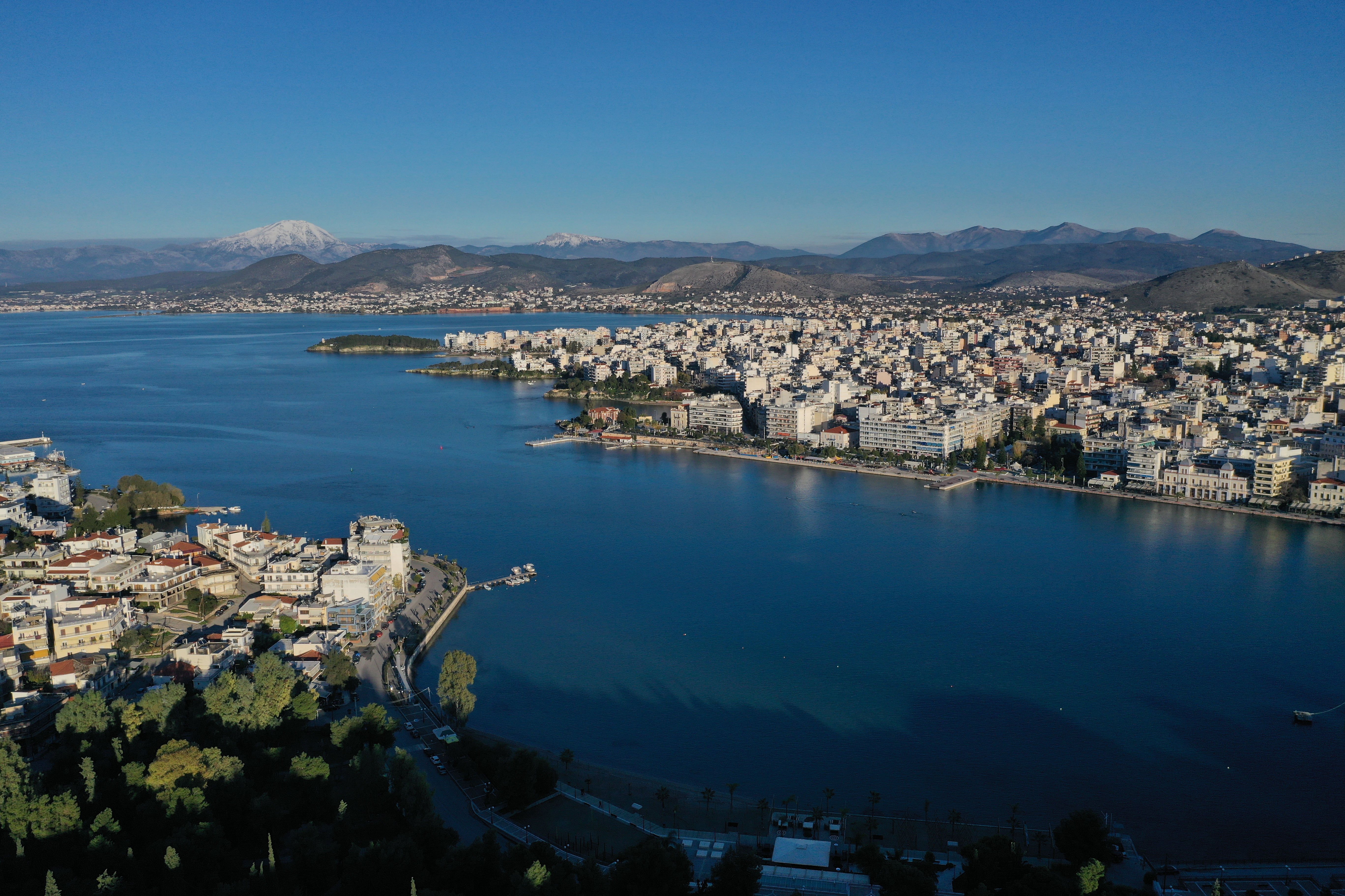
The tidal phenomenon of Euripus is unique in the world and it is considered a highlight when visiting Chalkida. The waters flow like river waters and move constantly, changing direction every 6 hours towards the North and the South Gulf of Evia respectively. Every time the waters are about to change direction, they remain stagnant for a few minutes. The only time this 8-minute pause does not happen is on the two equinoxes (21 March and 21 September), when the change of direction happens without a break. Sometimes, depending on the phase of the moon (full moon / new moon), they flow incoherently without a standard point of reference in their movement.
Purple Cave ● Evia
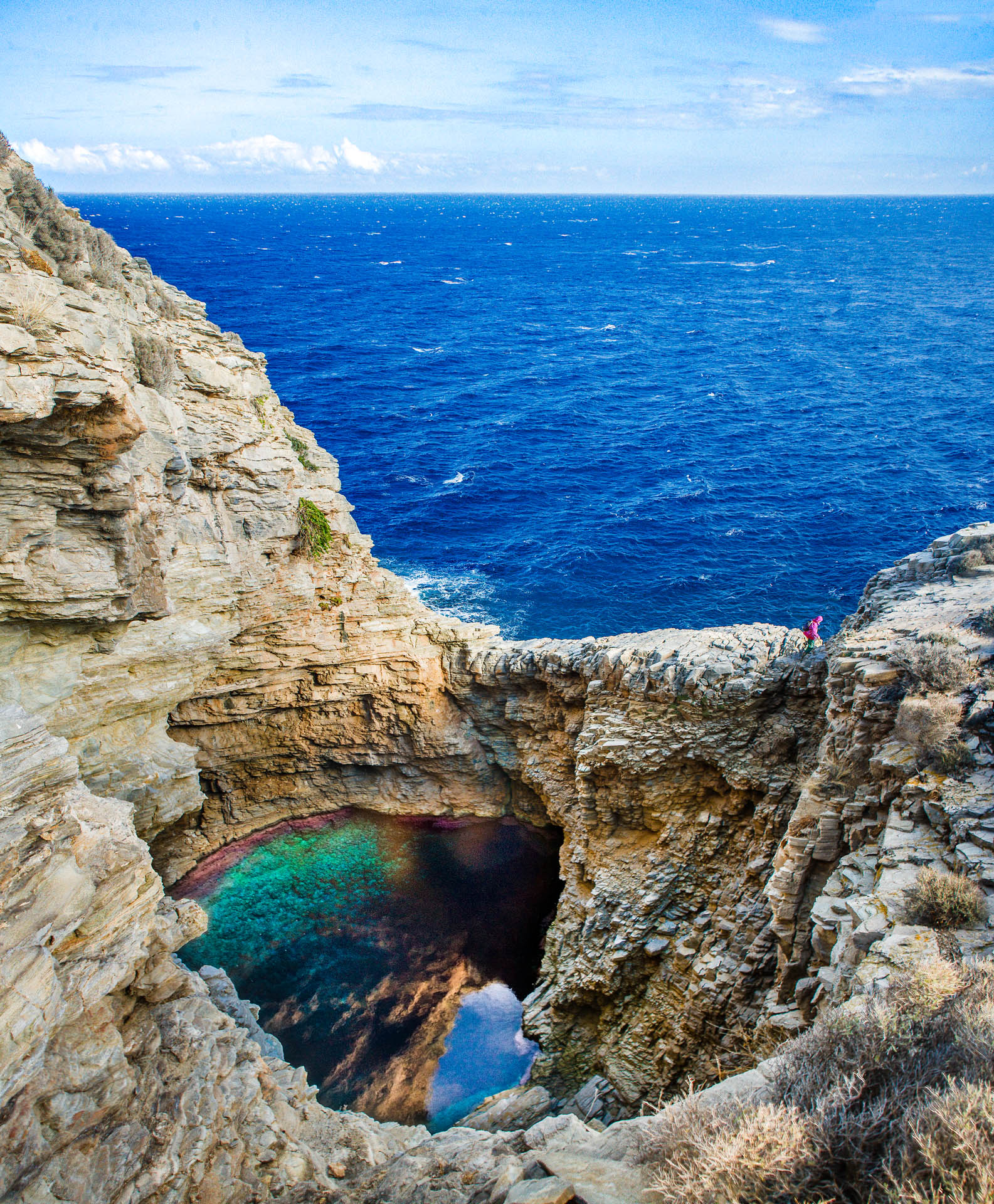
Located near Zarakes village, the Purple Cave is an impressive natural monument, an awe-inspiring masterpiece of nature that was named after the purple algae growing on its rocks. It is a sea cave, only accessible by water.
Aidipsos Baths ● Evia
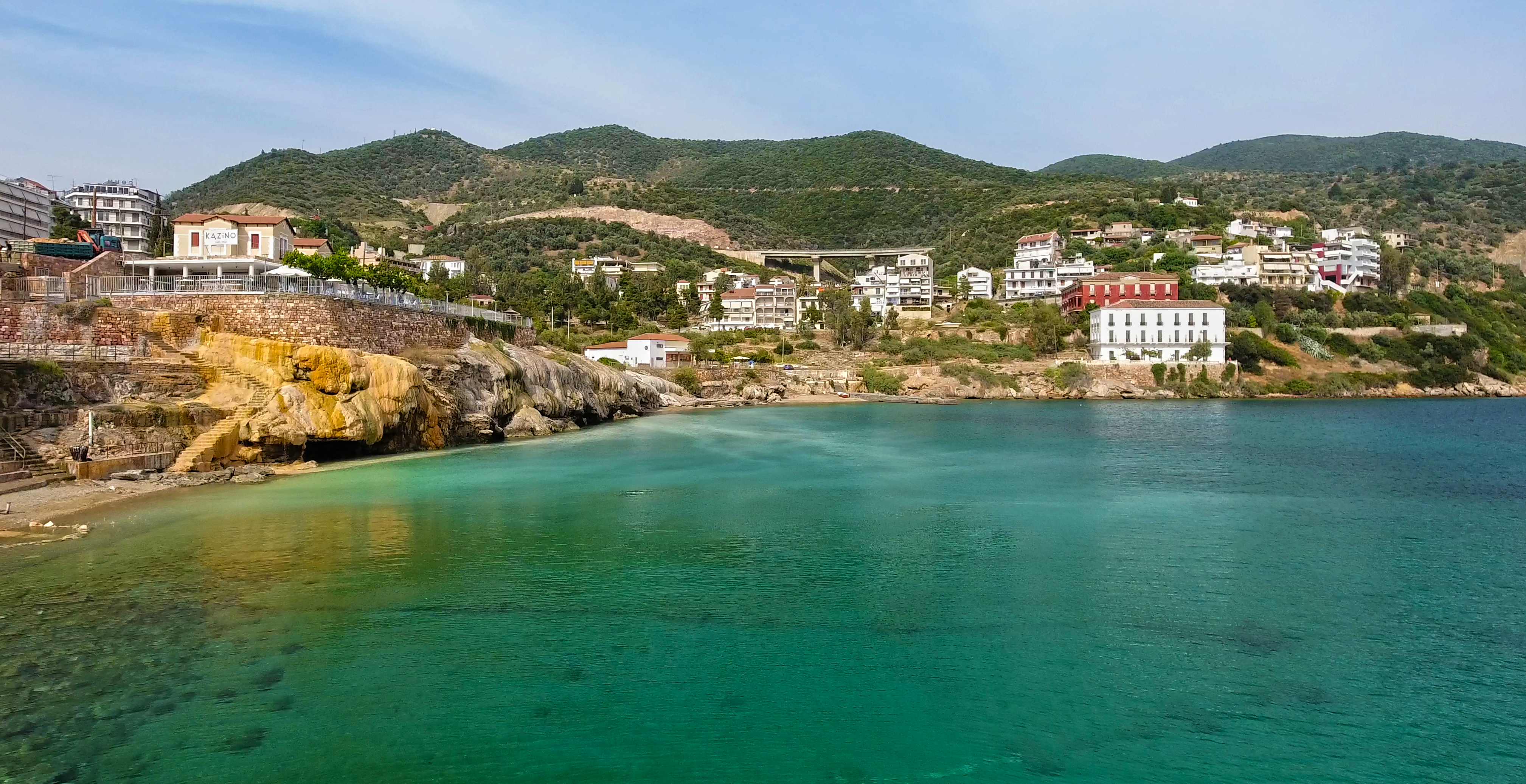
More than 80 thermal springs and a beautiful landscape of rich vegetation touching the turquoise sea set the scene in Aidipsos. According to the Greek mythology, Athena asked Hephaestus to create some thermal springs, so that Hercules could find rest after each of his Labours and he chose Evia. Over time, the healing properties of these springs have attracted emperors such as Hadrian, Marcus Aurelius, and Constantine the Great. Even Aristotle, the famous philosopher, sought to explain the phenomenon of the thermal springs of Aidipsos.
Petrified forest of Kerasia ● Evia
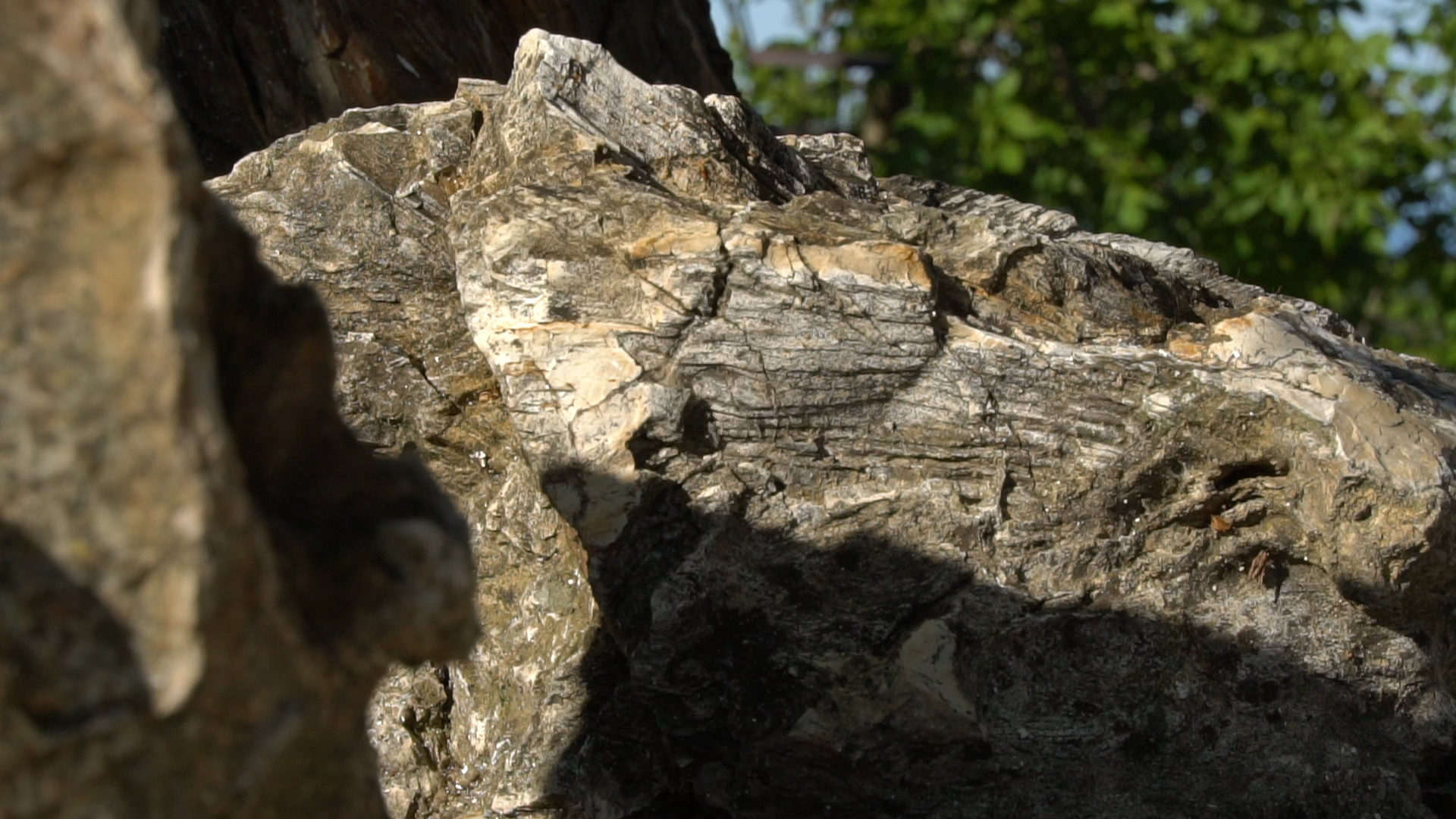
Located near the villages Agia Anna, Papades and Kerasia, the beautiful Petrified Forest of Kerasia is one of the few remaining forests of this kind in Europe and is estimated to be around 20 million years old. The fauna of the area used to be particularly rich, including, among other, prehistoric mammals, such as machairodus, helladotherium, chalicotherium. The significant findings of the paleontological excavations are exhibited in the Museum of Fossilized Mammals in Kerasia.
Skyrian horses ● Evia
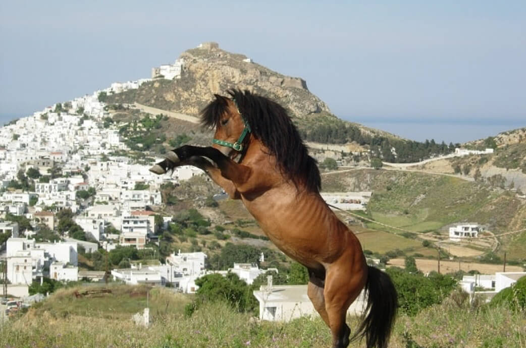
The southeastern part of the island is the habitat of Skyrian horses, the rare horses that belong to the Eguus Cabalus Skyriano species. It is an ancient breed of tiny, semi-wild horses, dating from the Classical period. Its geological origins are lost in the mists of time. The Skyrian horses are very friendly with humans and have been the symbol of Skyros island for a long time.
Centuries-old olive trees in Almyropotamos ● Evia
In Almyropotamos you will see trees with many years of life. There are centuries-old olive trees with important morphological features proving that they are around 2,500 years old. They are located near the church of Virgin Mary and are protected by the Ramsar Convention, showcasing the outstanding colour of this unique landscape.
Lake Kremasta ● Evrytania
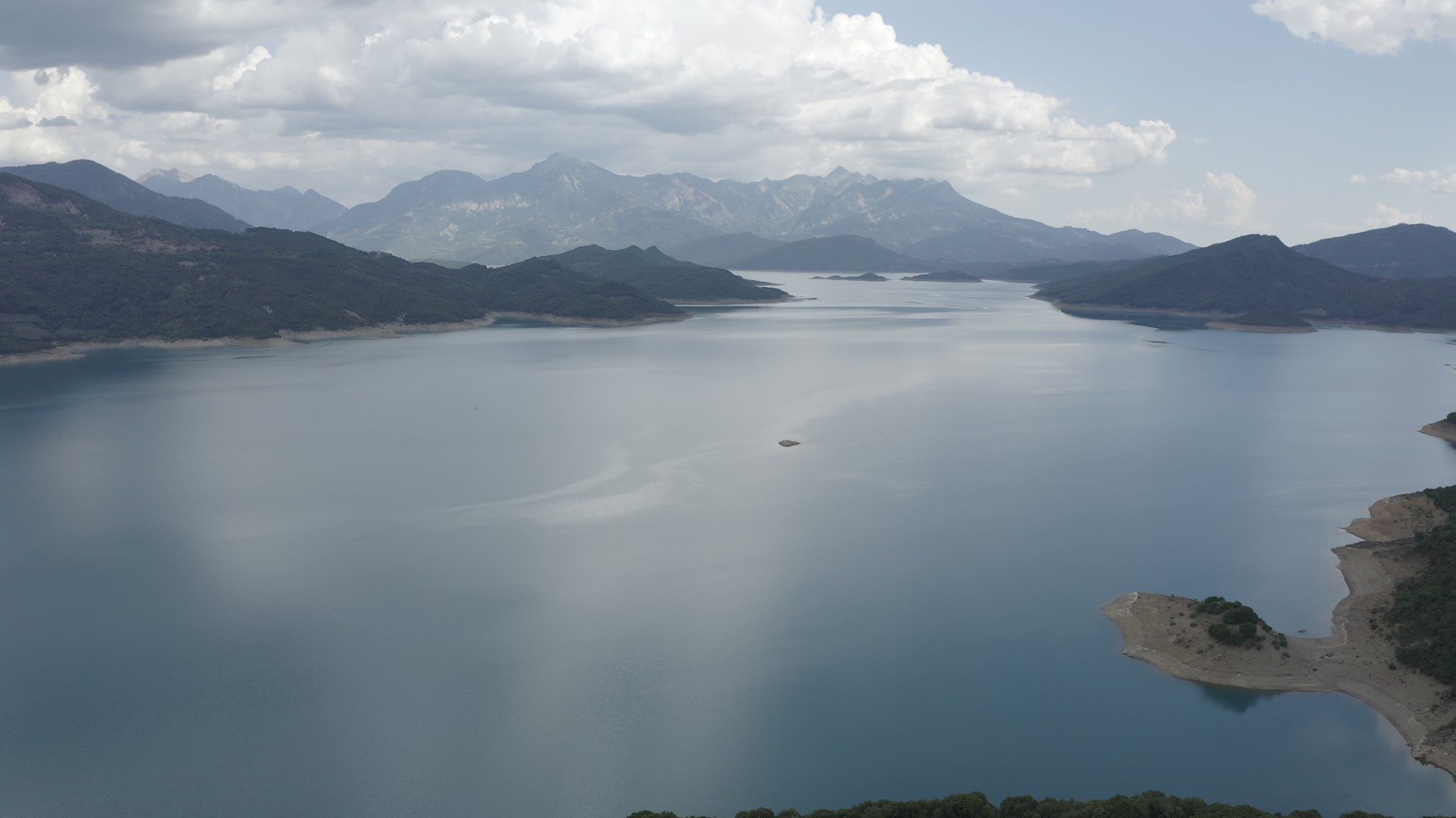
The largest and one of the most beautiful reservoirs in Greece, Lake Kremasta is located between the regional units of Aetolia-Acarnania and Evrytania. It was created in the 1960s, after the construction of the hydroelectric dam of Kremasta, and is constantly supplied with water from rivers Acheloos, Agrafiotis, Tavropos and Trikeriotis. The turquoise waters of the lake and its numerous little islets create a captivating scenery, reminiscent of exotic destinations. Sports lovers can enjoy canoeing, kayaking or even rafting in its calm waters.
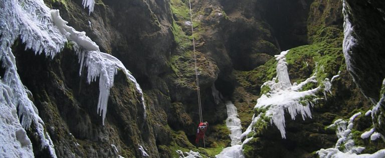
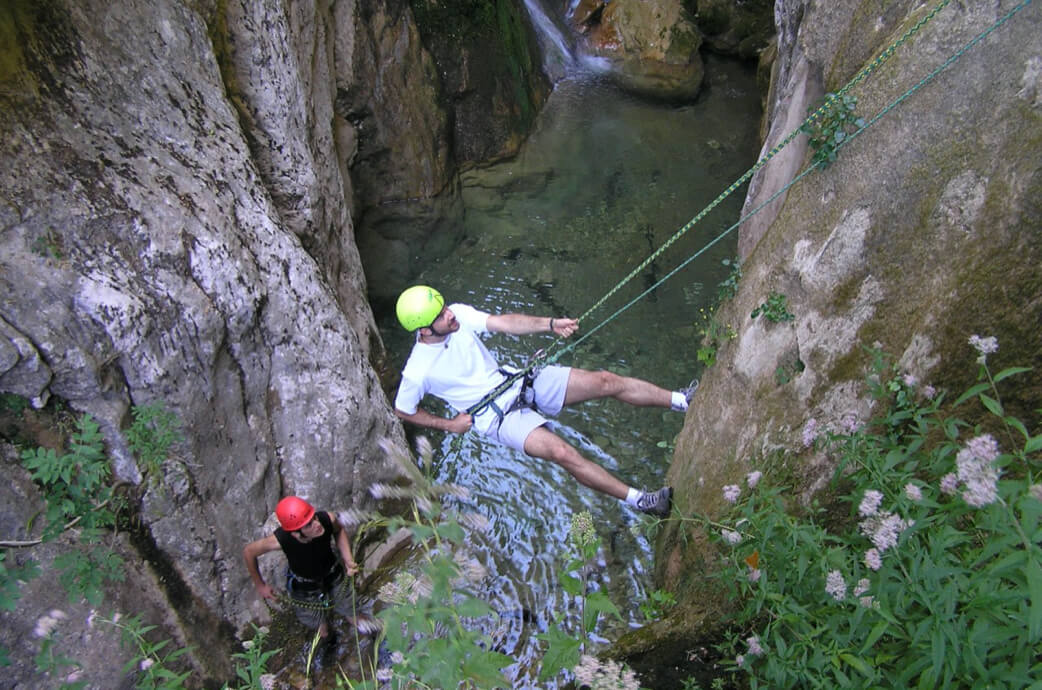
Mavri Spilia Gorge ● Evrytania
Panta Vrehi Gorge ● Evrytania
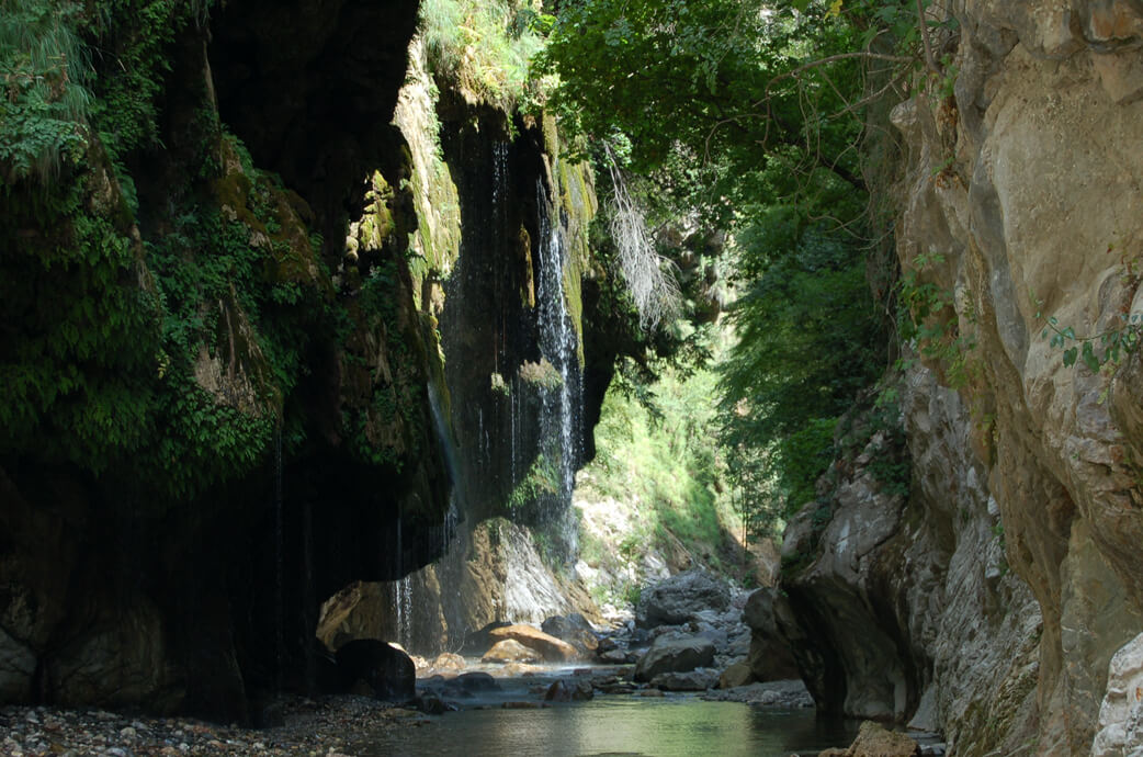
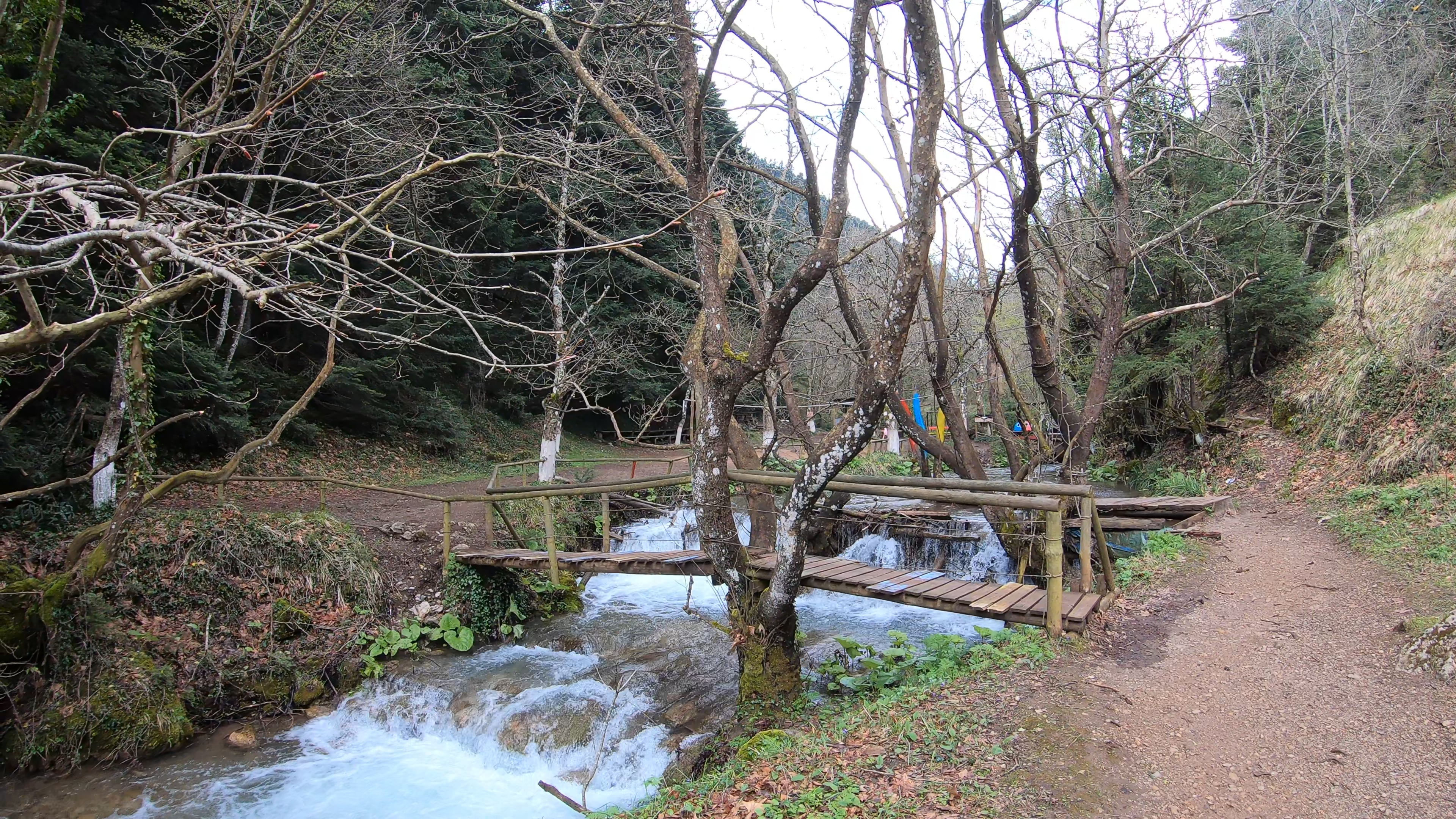
Top landmark in Evrytania, Panta Vrehi is one of the most beautiful gorges in the country and a true miracle of nature. It was named after the fact that at one part of it, which is around 80m long, the cold waters flowing from the rugged Kaliakouda mountain, trying to reach the waters of Krikeliotis river, find an outlet through the springs at the top of the gorge, thus creating beautiful waterfalls (Panta Vrehi means “always raining” in Greek). Because of the height, the water flow is interrupted and falls like raindrops, creating an impressive natural effect. The gorge can be reached by car only until a certain point, and then it can be explored by river trekking.
Thermopylae ● Fthiotida
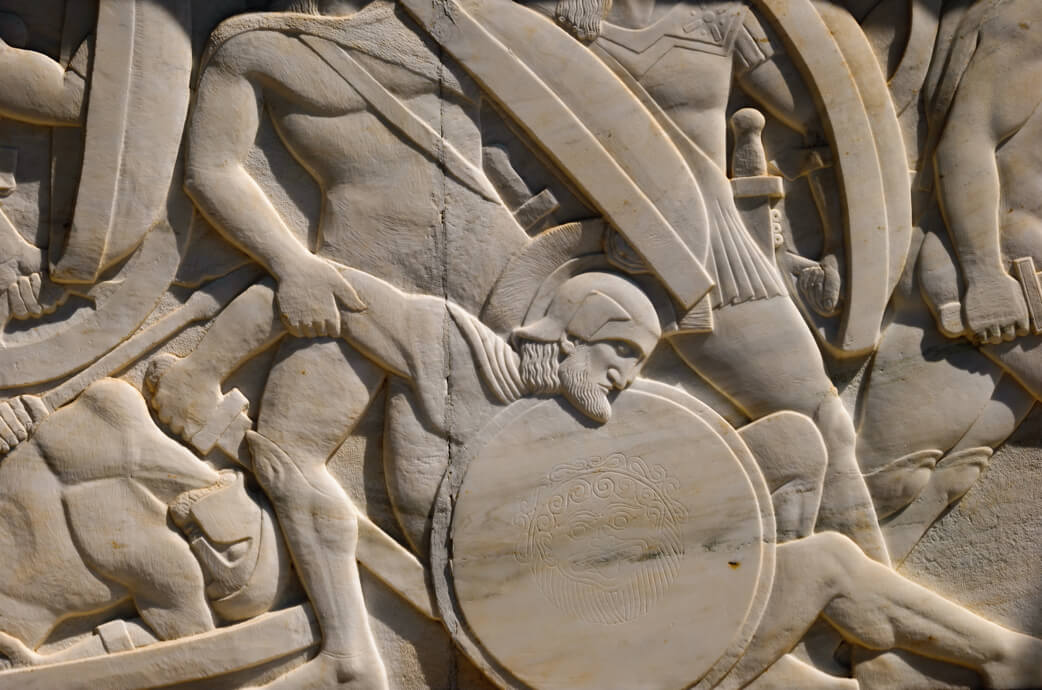
A narrow stretch of land between the southeast foothills of mount Kallidromo and the Malian Gulf, named after the thermal springs that existed there. In antiquity, this was a place of great strategic importance and a common battlefield, as it was the only accessible land passage between northern and southern continental Greece. Thermopylae is a place of great archaeological importance, because of the battle of 480 BC, when the outnumbered Greeks, consisting of 300 Spartans and 700 Thespians, under the leadership of Spartan King Leonidas, confronted the numerous Persian troops, under the leadership of King Xerxes I.
Lamia Castle ● Fthiotida
Built on the highest point of Lamia city, on top of a rocky hill, the castle overlooks the entire Sperheios valley until the Malian Gulf. It is one of the most important monuments in the town, with a history dating from the 5th century BC until the World War II, as shown by the archaeological finds. Inside the castle, at the top of the citadel, ThetArchaeological Museum of Lamia is housed in the renovated barracks from the period of King Otto. The museum collection includes archaeological finds from Fthiotida and Evrytania, dating from the prehistoric times until late antiquity.
Leonidas monument ● Fthiotida
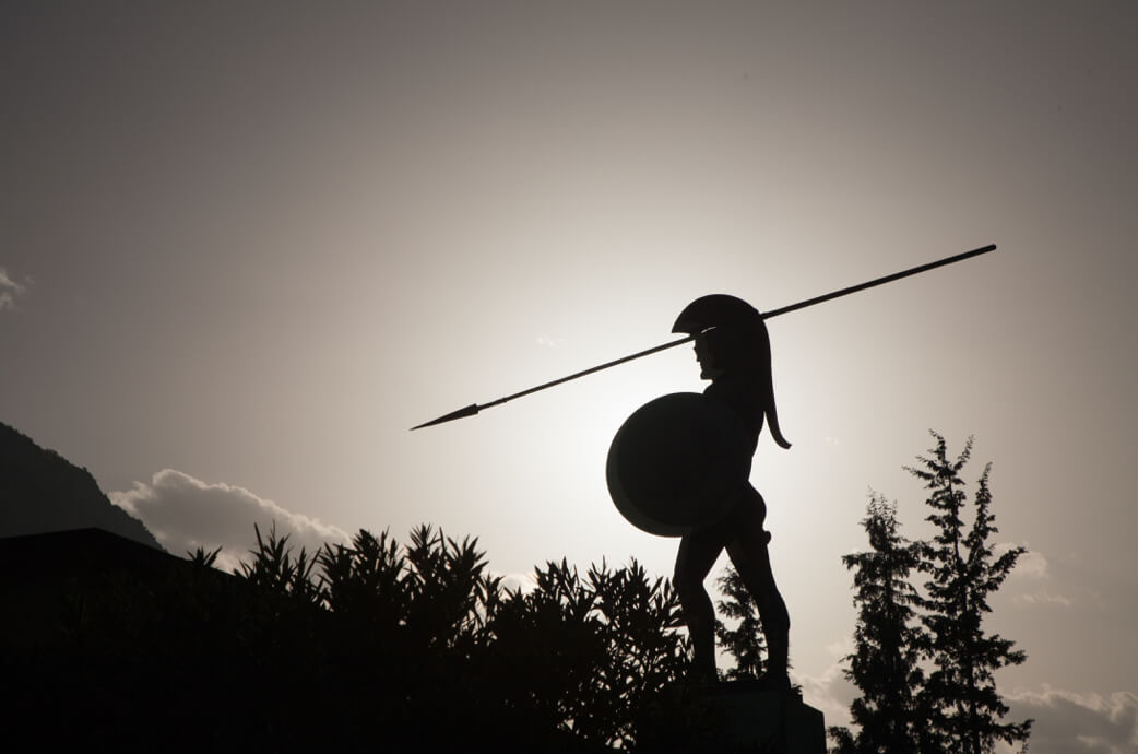
The famous Heroon of Thermopylae consists of a bronze statue of Leonidas holding his spear and his shield. Left and right of the statue, at a lower level, there are two marble statues that depict the personalized images of mount Taygetos and river Evrotas. It was created in 1955 by sculptor Vasos Falireas, as a memorial of the well-known Battle of Thermopylae (480 BC), where Spartan King Leonidas and his 300 soldiers, along with 700 Thespians and 80 Mycenaeans lost their life fighting Persian King Xerxes I in his campaigne against Greece.
Gorgopotamos Bridge ● Fthiotida
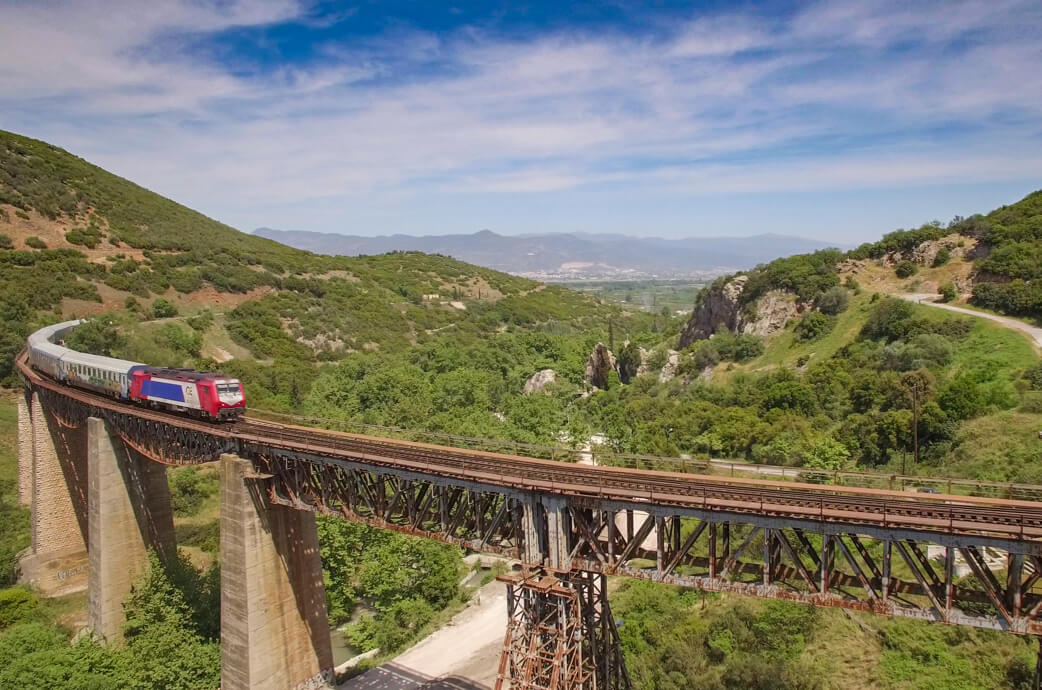
Gorgopotamos bridge is one of the most popular bridges in Greece. It crosses river Gorgopotamos and connects Bralos with Lamia and is also used for the railway connection of Athens with Thessaloniki. It is a historical landmark, associated with the Greek War of Independence in 1821 (in the Battle of Dema) and the National Resistance against the German occupation forces (November 1942).
Ancient Citadel of Proerna ● Fthiotida
Proerna used to be an important town at the northwestern edge of Achaia in Fthiotida. Not much is known about its history, but the archaeological findings architectural remnants prove continuous habitation from the prehistoric until the Roman times. The ancient citadel is located in Neo Monastiri, Domokos, Fthiotida, and is fortified with 2.5m-wide walls made of massive limestone blocks, dating from the Hellenistic period.
Medieval Frankish Castle of Domokos ● Fthiotida
The well-preserved medieval Frankish castle is located near the picturesque square of Domokos. Parts dating from the Cyclopean walls of the ancient castle still remain in the west wing of the castle. Throughout the Byzantine period, the hill had always been fortified, but the walls that remain until this day are probably remnants of the Frankish period. The views from the castle are spectacular.
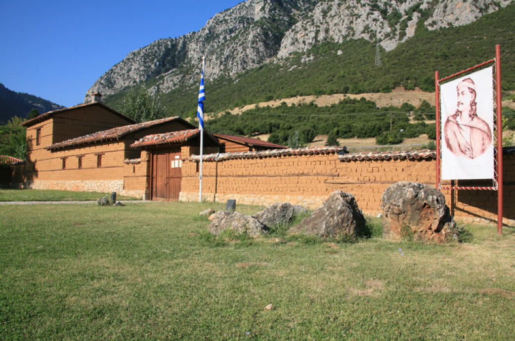
Astronomy School of Ypati ● Fthiotida
The “Kakogianio Asterosholio” (Astronomy School of Kakogiannis) was built in late 2010 in Ypati village, at a distance of 20km from Lamia. It is housed in the old building of the Primary School of Ypati, which was granted by the former Municipality of Ypati (the present Municipality of Lamia) and its equipment was donated by Stavros and Irini Kakogiannis from Ypati. It is a unique research institute, aiming at bringing people closer to the science of astronomy, with modern facilities including an auditorium, an observatory and a planetarium.
Sperhios Delta ● Fthiotida
River Sperhios flows from Tymfristos at 2,327m and flows into the Malian Gulf where its Delta is formed. The soil is silver and silty, rich in calcium and magnesium and moderately enriched with potassium. The area has an interesting flora and fauna and the vegetation along the riverbanks is bushy, while in the centre it is low and sparse. The fauna in the area is particularly rich and provides shelter to rare species.
Aesthetic forest ● Fthiotida
Located in the south part of Kato Tithorea village, the aesthetic forest offers the visitor the chance to marvel at a unique landscape. Due to its great aesthetic (hence its name), environmental and touristic importance, its flora, fauna and beautiful habitats need to be protected. The vast area of the forest is covered with dense vegetation, mainly oaks, cedars, firs and self-sown trees. Inside the forest, there is one of the two towers of the ancient wall that are still standing today.
Thermal springs of Kamena Vourla ● Fthiotida
Kamena Vourla is a popular bath town built between mountains and the sea, in the southeast part of the Malian Gulf and the slopes of mount Knimis. Since the 1960s, the town is considered a timeless tourist resort. The various thermal springs of the area deliver water with different chemical properties and a temperature ranging between 30 and 42°C, suitable for the treatment of many health conditions.
Ypati Thermal springs ● Fthiotida
Located at an altitude of 90m and at a distance of 19km from Lamia, within a lush area of the Fthiotida plain, near the foothills of Oiti, the springs cover an area of about 0.9km2. The thermal springs are famous for their healing properties since the 4th century BC and their organised use started in 1805. A modern hydrotherapy centre with up-to-date facilities was built and set in operation in 1960. It should be noted that the water temperature is close to the body temperature, which is ideal for hydrotherapy.
Thermal springs of Ampla Paleovrahas ● Fthiotida
Located in west Phthiotis, within 5km from Makrykomi, close to river Sperhios, the thermal springs of Ampla (which means spring) welcome their guests in state-of-the-art facilities, offering therapeutic baths in thermal pools with a water temperature of 26°C . The natural landscape is unique, as the whole area is covered in lush vegetation.
Plane tree forest of Kompotades ● Fthiotida
At a short distance from Lamia town, this beautiful forest is located in a lush environment along Sperhios river, near Kompotades village. It covers an area of around 1 km2, and has a variety of tree types, offering to its visitors the chance to get familiar with some rare species. In Homer’s poems, this area was mentioned as a wood source point for making masts for the ships used back in the day.
Kathreptis of Arkitsa ● Fthiotida
Kathreptis of Arkitsa is an important geological phenomenon, consisting of a vertical rocky surface with streaks formed by the friction of rocks over consecutive earthquakes over the centuries. It forms part of the Arkitsa-Kamena Vourla fault and is 300m long and 80m high. It was named after the fact that it is reminiscent of a mirror (Kathreftis means “mirror” in Greek), and it is a very impressive place to visit, especially when, from a close distance, one can see the vertical shining surfaces rising abruptly.
Plane trees of Lamia ● Fthiotida
Four impressive centuries-old plane trees stand out at the central square of Lamia and steal the show in the urban landscape. These huge trees always impress visitors with their incomparable beauty. As they have been standing here for so many years, they are a characteristic landmark of the city and at the same time create a small green oasis in the city centre.
Pavliani Park ● Fthiotida
Within just 235km from Athens, built at an altitude of 1,050m, at the entrance of the National park of Mount Oeta, Pavliani is a lush green village with rich flora and fauna. It is a unique place, ideal for various activities in nature. In the park, you can walk on colourful bridges over the river, climb tree houses, and admire river Asopos, or maybe enjoy a swim in its cold waters, if you dare to do so!
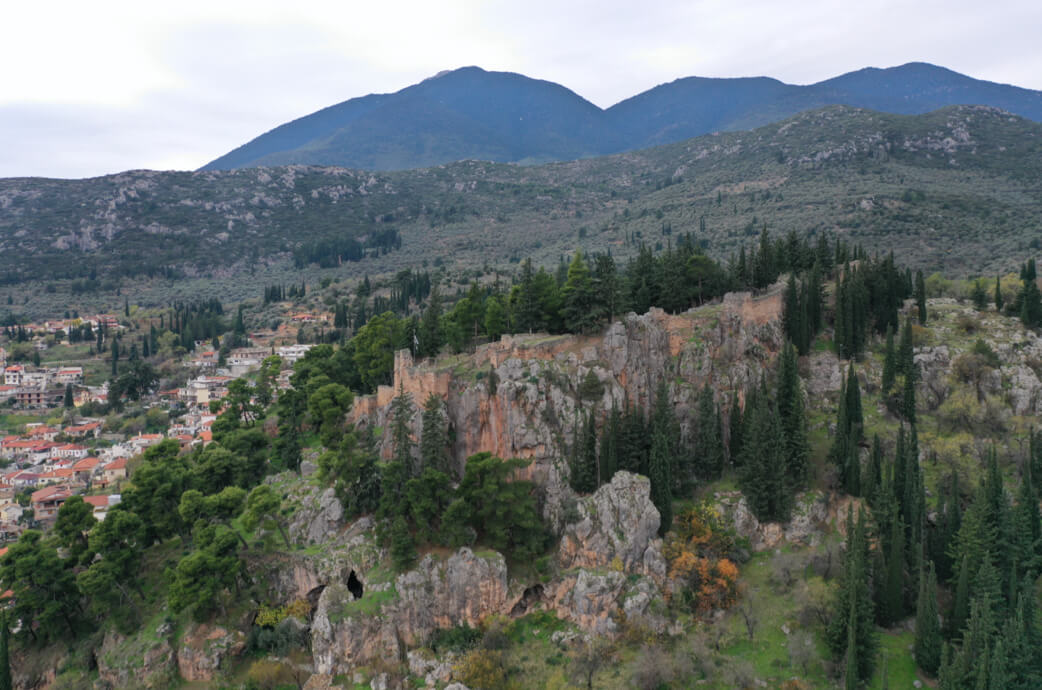
Delphi ● Fokida
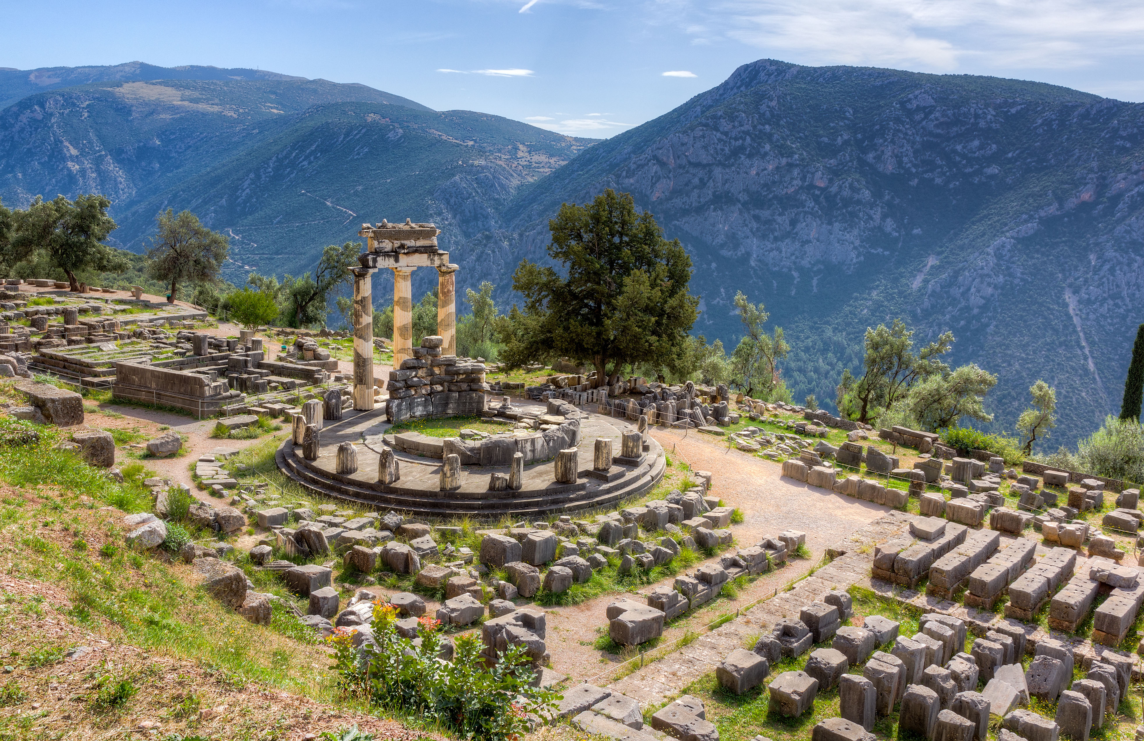
Visiting Delphi is like a time travel in a fascinating area of the Greek land. In Delphi, known as the “navel of the earth”, the rich various monuments are combined with a unique natural landscape and an intangible cultural heritage, myths, the famous oracle and ancient tragedy. The Delphic landscape comprises the Itea Gulf, the traditional olive grove of Amphissa, Delphi and Hrissos, and the mountainous front formed by mounts Faidriades. The archaeological site covers the whole slope of the hill and is filled with monuments, to be seen at every step the visitor takes. The Archaeological Museum of Delphi is one of the most important museums in Greece and its collections include ancient objects and mainly offerings dedicated to the sanctuary.
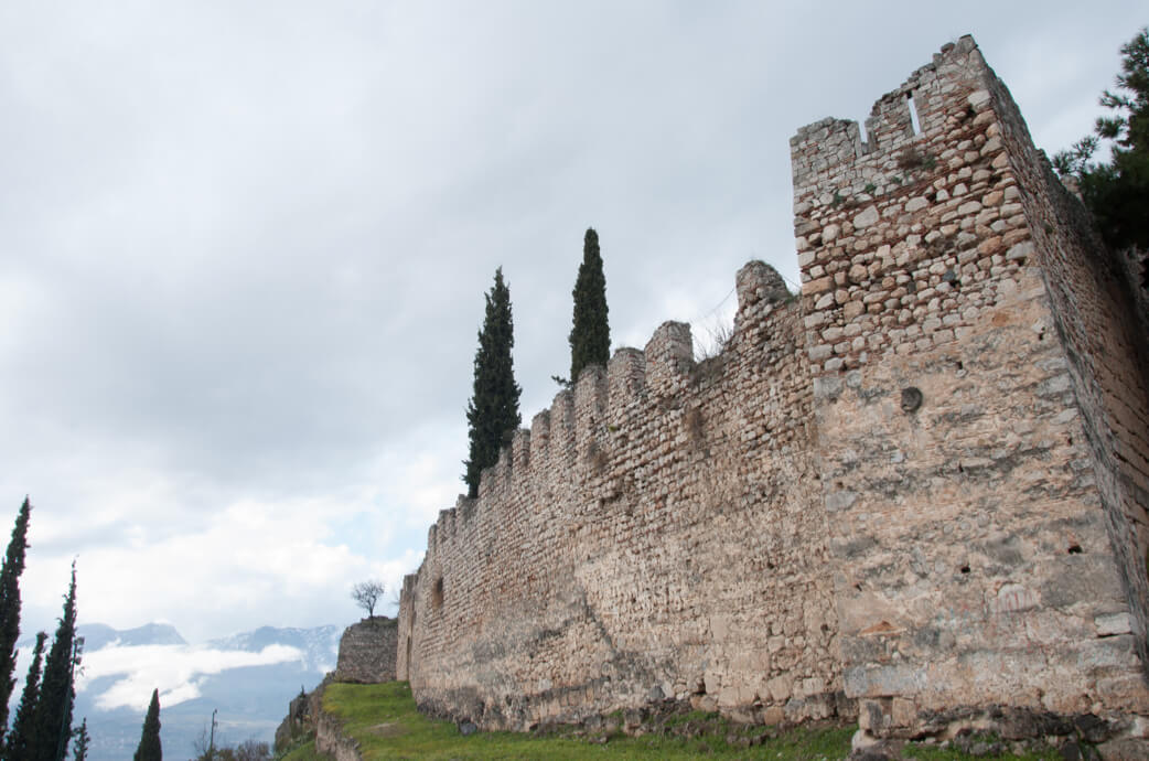
Castle of Salona ● Fokida
The castle of Amphissa, also known as the Castle of Salona the Castle of Oria, stands majestically over the town, on a rocky hill of 225m, at the site of an important ancient Greek citadel. Counting centuries of presence in the area, its history dates back to the time of the Pelasgians and the Classical antiquity until the Greek War of Independence.
Hani Gravias ● Fokida
Located in Gravia town, opposite the church of Agios Athanasios, Hani Gravias is a place of great historical importance. Its name is connected with the most important pages of Greek history, as this is the place where, in May 1821, during the Greek War of Independence, the Greeks, under the leadership of Odysseus Androutsos won for the first time against the Ottomans. The modern-day building imitates the brick building that stood there back in the day and was destroyed. There is also a bust of the main hero of the battle just across the building.
Mining park ● Fokida
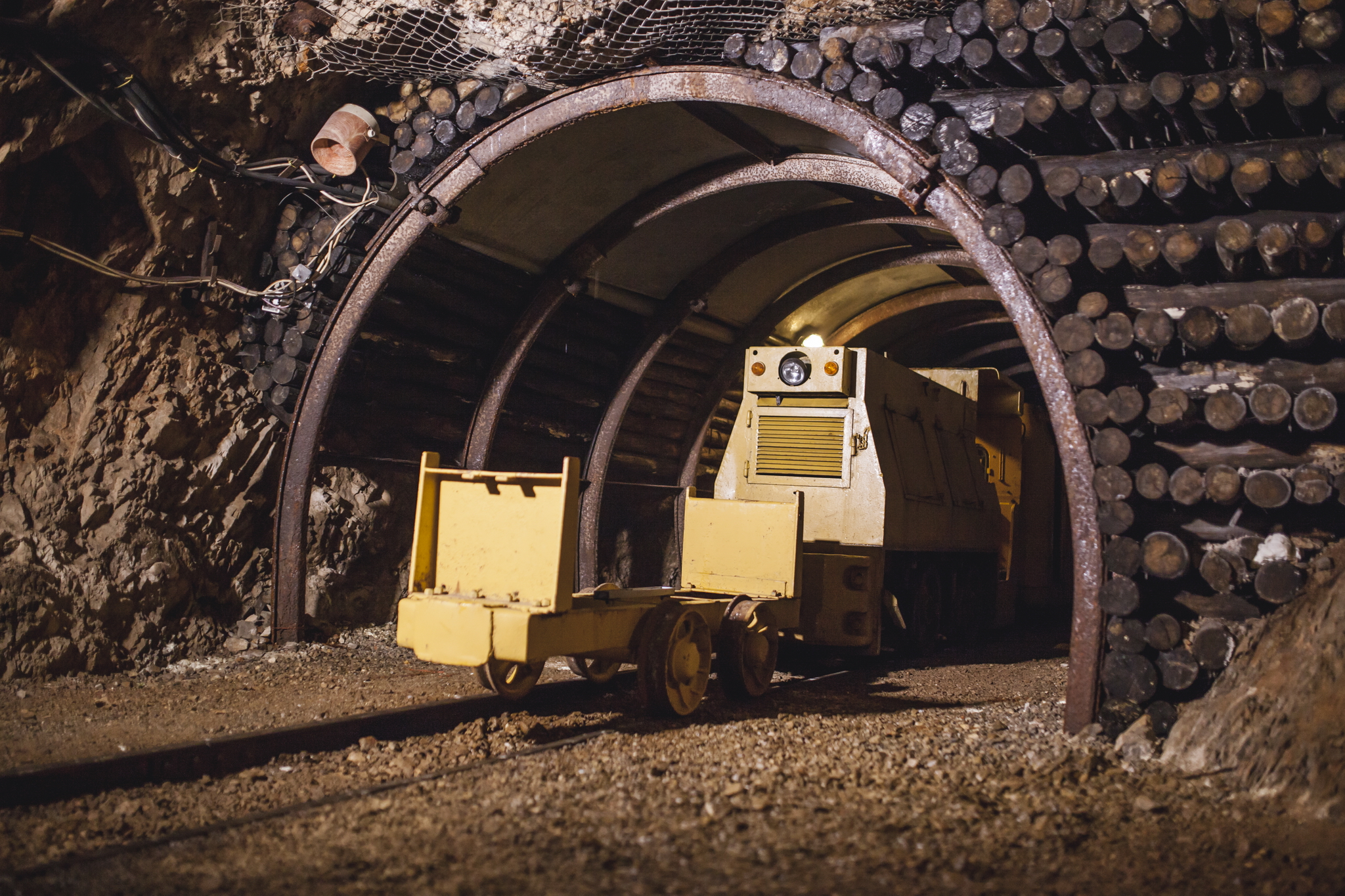
The Mining park is located on the national road connecting Lamia and Amfissa, south of Gravia. The visitors have the chance to be initiated into the history of bauxite and the way it was mined in the area of Phocis. After the mines closed in 1972, because of depletion of the mineral reserves, visitors can board the small wagon used by the miners to transport bauxite and travel in the past, going down in a depth of 200m, to discover the secrets of the tunnels and learn about the tough work of the miners.
Mornos Reservoir ● Fokida
One of the most beautiful reservoirs in Greece, lake Mornos is located in the mountainous part of the region, within a landscape of unrivalled beauty. Mornos lake was formed after the construction of the dam in river Mornos in 1979, to cover the water-supply needs of Athens. Today, the lake provides the Greek capital with high quality freshwater, which is among the best in Europe. The total perimeter of the lake is about 65km and it takes just around 2 hours to explore the whole area.
Trizonia ● Fokida
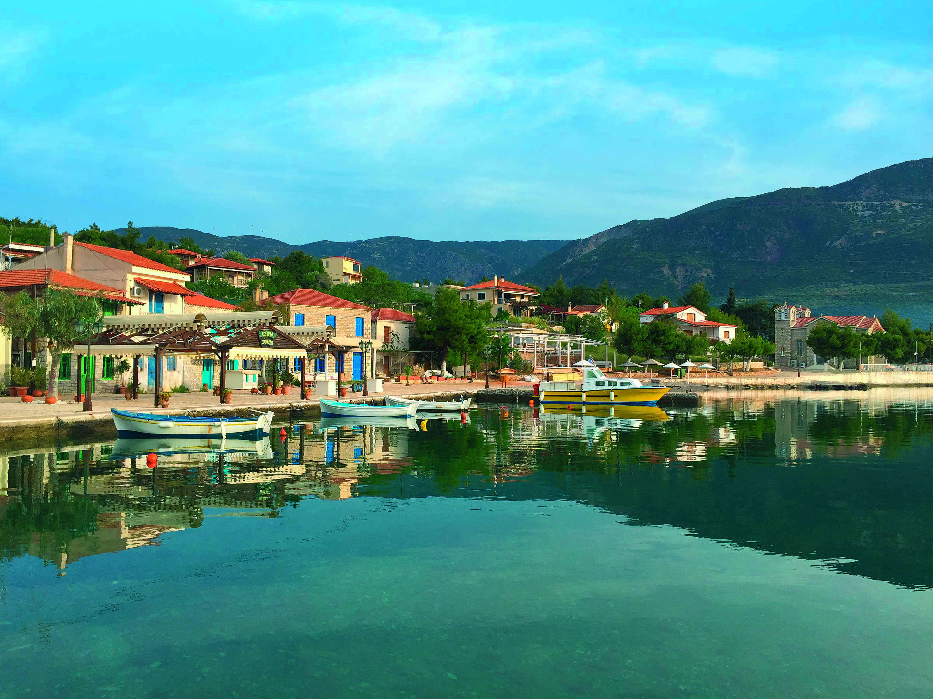
Lesser-known Trizonia is the only island in the Corinthian Gulf. Covering an area of just 2.4km2, it forms part of the island group of the Corinthian Gulf, along with two smaller uninhabited islets called Ai-Giannis and Planemi. Easily accessible by fishing boats from the land across, close to Nafpaktos, it offers wind-protected beaches and a picturesque harbour.